 Bearlywild
Hiking
Is This the Best View in Vancouver? St. Mark's Summit at Cypress
September 6, 2026
We'd planned to hike Golden Ears that morning. We got to the trailhead, realized we needed a day-use pass we hadn't booked, and had to bail. St. Mark's Summit at Cypress was the backup plan — we pulled into the lot around 9am on Sunday, September 6, and there were plenty of spaces still open. No reservation needed, no pass required, just a ski resort lot that happens to be free in the off-season.
Permits & access
Parking at Cypress is free and unreserved — no day-use pass, which is exactly what tripped us up at Golden Ears earlier that same morning. Worth remembering if you're choosing between North Shore trailheads on short notice.
The route
The trail starts at a signpost near the lodge and is well marked the whole way. It opens with a gentle climb through a rooty section, nothing steep, and at 9am on a Sunday we barely saw anyone. From there it crosses a gravel access road, runs flat across a gravel-and-rock stretch, then drops back into forest for a gentle, sustained climb with some early views opening up through the trees.
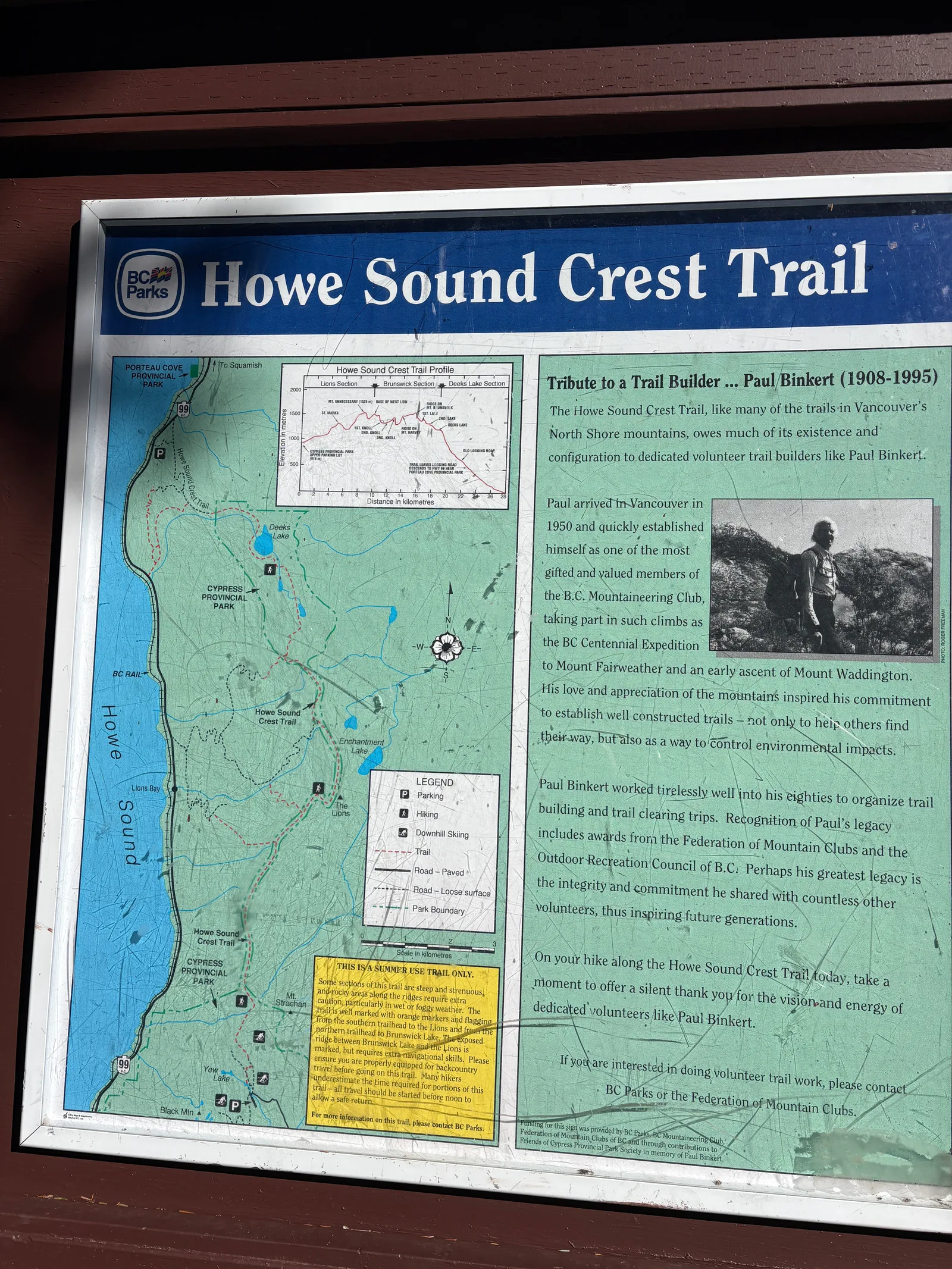
About 40 minutes in, we hit the fork for Bowen Lookout, a signed 500 m spur off the main trail. We took the detour — flat at first, then a short dip you have to climb back out of, about 10-15 minutes each way. It's worth it: islands, Howe Sound, and a clear blue-sky view with only a handful of other people up there. We spent about five minutes taking it in before heading back to the main trail.
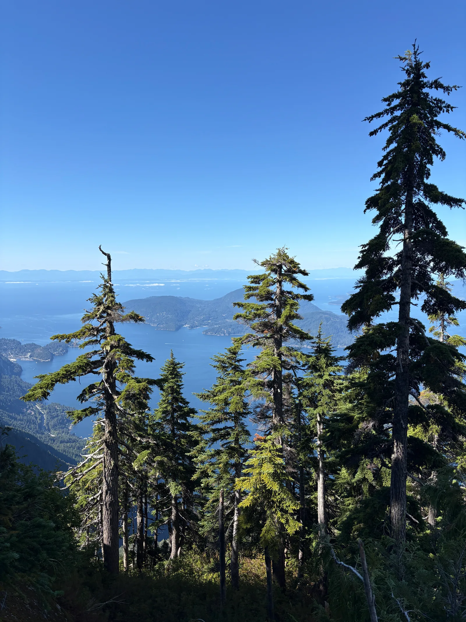
Past the Bowen Lookout junction, the trail surface changes: less root, more packed dirt, with a cliff dropping away on one side and ocean views opening up on the other. It stays fairly flat until a left turn, where a steeper section starts. This stretch looked recently maintained, resurfaced with gravel in a few spots, and climbs through several switchbacks up to the ridge.
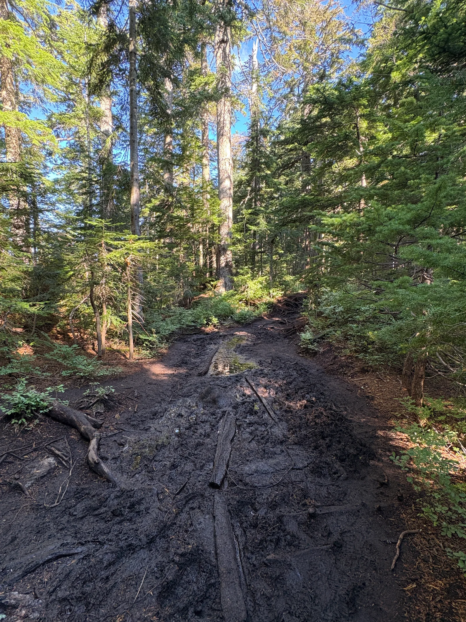
After the ridge, the trail changes character again: a shaded, muddy stretch where roots cover the ground almost like a carpet, not steep but relentless underfoot. Then a genuinely steep switchback section, still muddy, still rooty — and this is where we started running into real crowds for the first time all day. Up to that point the trail had been quiet; here, a lot of people were visibly struggling with the uneven, slick footing.
The payoff
About an hour after the Bowen Lookout detour, we reached St. Mark's Summit. The view is one of the best we've had near Vancouver: the sea, the islands, a fully panoramic feel. A Steller's jay landed on a rock right next to us while we ate a snack, calm enough to get a close photo.
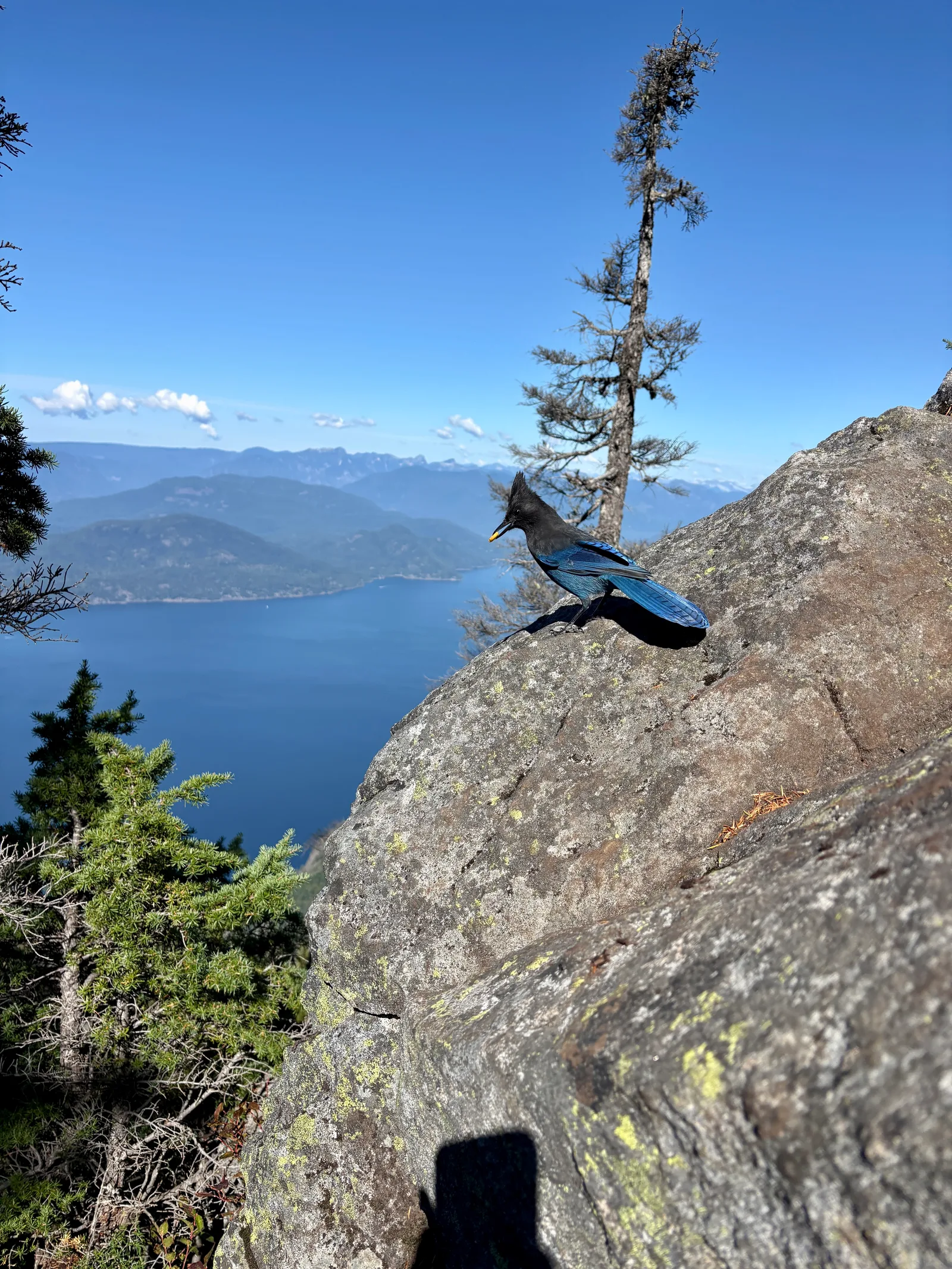
We heard voices below and followed them over the ridge to a second viewpoint that turned out to be even better than the summit itself — no trees at all, just open rock and a completely unobstructed view of Howe Sound. Every other viewpoint on this hike has trees softening the view somewhat; this one doesn't. We spent about 30 minutes there before heading back.
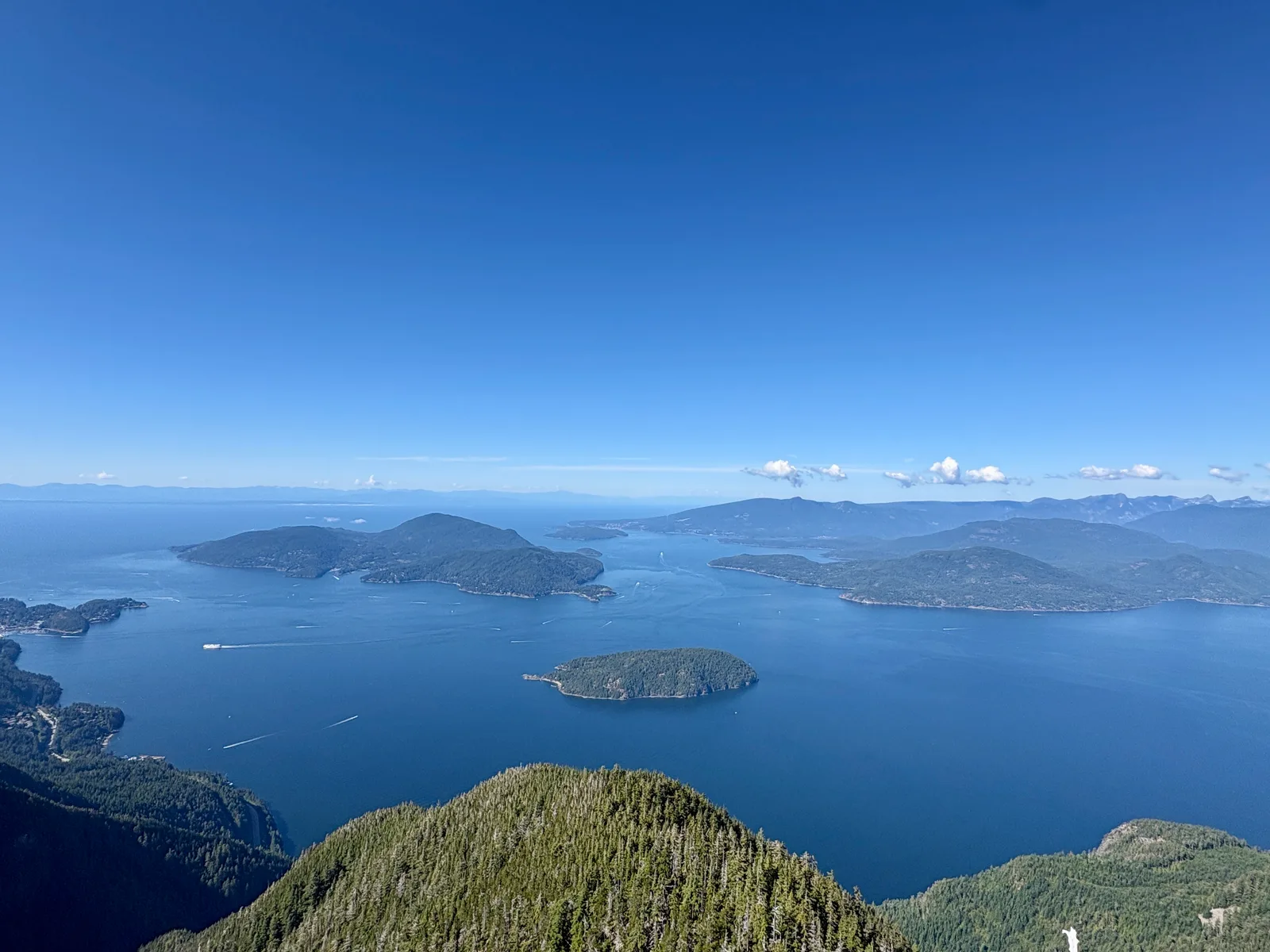
The trail was noticeably busier on the way down — a steady stream of people still heading up, later in the day than we'd started. We didn't stop on the descent. Total time out and back was about 4.5 hours. When we got back to the lot, it had gone from nearly empty to completely full, with people waiting for spots.
Trail notes
- Mud and roots are the defining hazard on the switchback sections, both on the way up to the ridge and after it. Trail shoes with real grip matter more here than on a lot of North Shore hikes.
- The trail was quiet before we hit the crowds past the ridge, and it stayed busy the rest of the way. Arrive early — we started around 9am and still watched the lot fill up behind us.
- Dogs are common on this trail, on- and off-leash. We saw a small toy-breed puppy struggling with the steep, rooty terrain — worth thinking about whether your dog is actually built for a trail this long and uneven before bringing them.
- Safety: this is one of the North Shore's more frequent search-and-rescue locations, which is worth knowing before you go. The Howe Sound Crest Trail, which the St. Mark's Summit route follows, was the second most frequent hiking location for search-and-rescue calls in all of B.C., logging 13 calls in 2022 alone (Pique Newsmagazine). Documented North Shore Rescue call-outs at or near St. Mark's Summit include hikers with fall-related injuries — ankle, shoulder, back — tied to the same muddy, root-covered, uneven footing we walked through (North Shore News), and hikers caught by darkness or losing the trail near the switchback down toward Strachan Meadows (Daily Hive). Bring real footwear, carry a headlamp even if you're only planning a few hours, and know where that switchback junction is before you're navigating it in fading light.
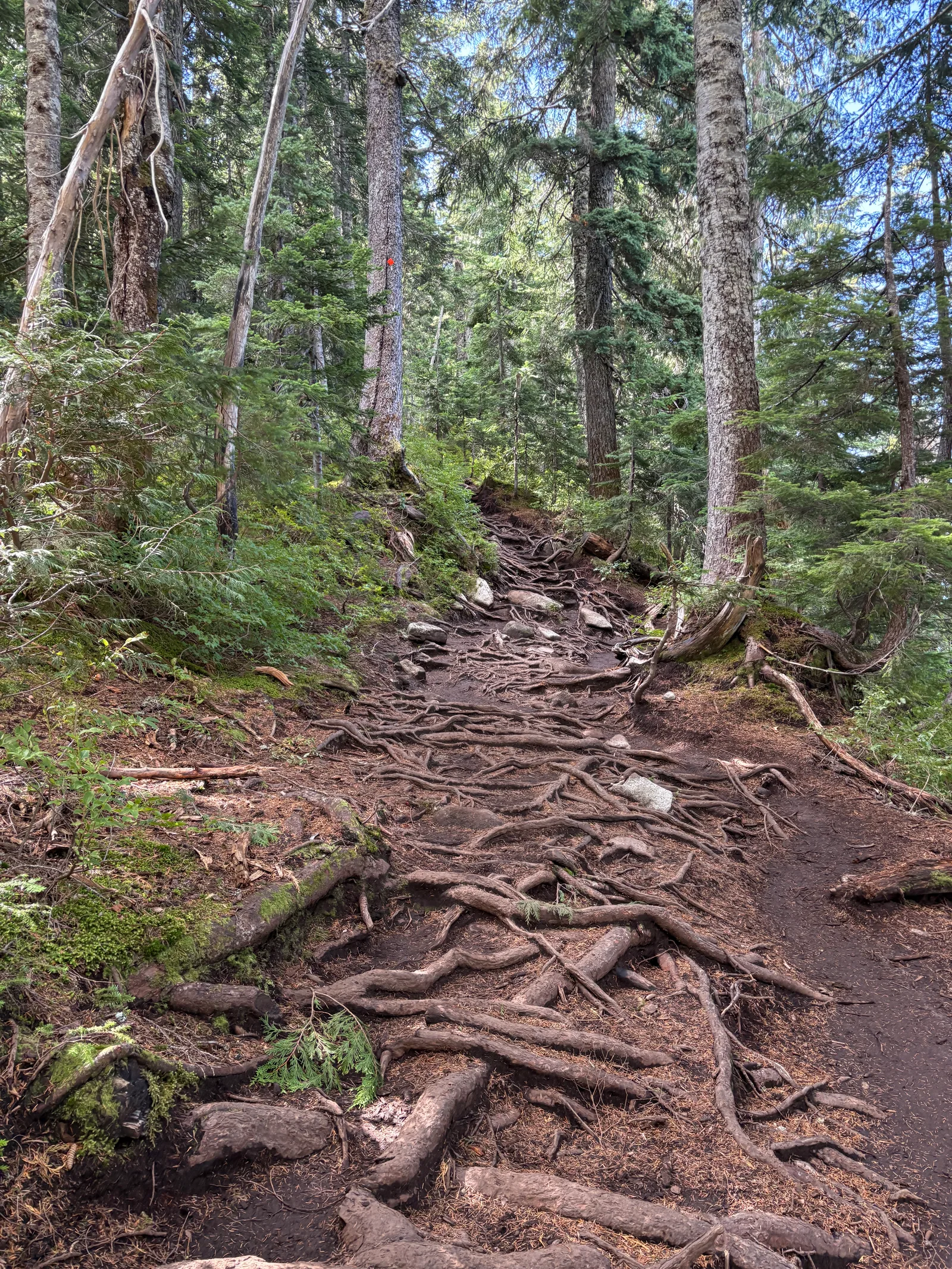
Overall: this is genuinely one of the best view-to-effort hikes near Vancouver, and it earns both its popularity and its rescue stats for the same reasons. It's well marked and non-technical, but muddy, steep in bursts, and busy enough that a bad step has real consequences. Worth doing. Worth respecting.